From the soft deltaic silts of Steveston to the older peat deposits near the oval, Richmond BC presents two very different faces to excavation contractors; one demands aggressive dewatering, while the other requires constant vigilance against lateral squeeze. With a population exceeding 230,000 and an average elevation barely one meter above sea level, the city’s subsurface is dominated by the Fraser River floodplain. This means groundwater is never far from the invert of your cut. Our geotechnical excavation monitoring program bridges the gap between design assumptions and field reality, tracking inclinometer data, piezometric pressure, and surface settlement markers so that a shifting utility corridor doesn’t become a shutdown. Before shoring goes in, many teams find a CPT test helpful for correlating pore pressure dissipation with the silt layers that complicate staged excavation near the dyke system.
In Richmond’s floodplain, a stable excavation wall at 9 a.m. can show 12 mm of movement by 3 p.m. if tidal pressure isn’t accounted for.
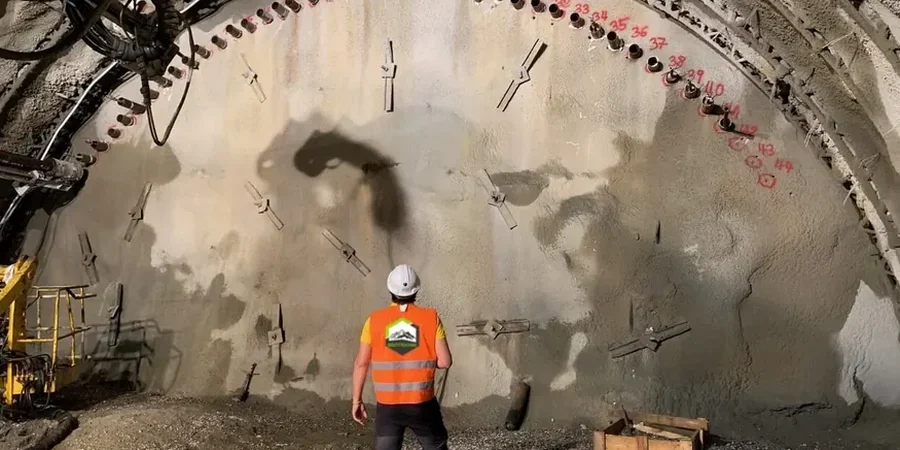
Methodology applied in Richmond BC
Demonstration video
Critical ground factors in Richmond BC
The single most common mistake we see on Richmond sites is treating the excavation as a dry-land dig and skipping piezometer installation until water appears in the cut. By then, the basal heave has already started. Contractors discover that the dark, organic silt at minus four meters has been losing strength for days, and the shoring system they braced for a dry section now faces hydrostatic loads it wasn’t designed to resist. The result is almost always a costly backfill-and-redesign cycle, sometimes with damage to adjacent shallow footings. In a city where the water table often sits just 1.5 meters below grade, delaying dewatering confirmation by even one shift introduces risk that no amount of post-facto grouting can fully reverse. Monitoring is not a compliance checkbox; it is the feedback loop that keeps the excavation stable when the soil behaves differently than the borehole log predicted.
Our services
Our monitoring scope in Richmond covers the full lifecycle of an excavation, from baseline surveys before the first bucket to final readings after backfill. The two core packages below can be combined or scaled based on shoring complexity and proximity to sensitive structures.
Deep Excavation Monitoring Package
Designed for cuts exceeding 4.5 meters or those adjacent to occupied buildings. We install inclinometer casings behind soldier pile walls and automated total station arrays to track lateral deflection in real time. VW piezometers at two depths capture the tidal groundwater lag that defines Richmond’s silty profile. Reports include vector plots of movement and a daily stability commentary signed by the responsible engineer.
Utility Corridor & Settlement Monitoring
Focused on shallow trenching near gas mains, sanitary sewers, and shallow foundations. Settlement plates and precise level surveys establish a pre-construction baseline. During the dig, we track differential settlement across the corridor at 12-hour intervals. If movement approaches 75% of the agreed threshold, the field lead triggers a review call with the superintendent so that shoring adjustments happen before the utility owner gets a surprise.
Frequently asked questions
What does geotechnical excavation monitoring cost in Richmond BC for a typical basement dig?
For a standard residential or light commercial excavation in Richmond, monitoring programs typically range from CA$1,050 to CA$3,600 depending on the number of instruments, the depth of the cut, and the required reading frequency. A five-meter-deep basement with one inclinometer, two piezometers, and weekly surveys sits at the lower end; a multi-sided commercial dig with automated prisms, daily reporting, and tidal correlation moves toward the upper end.
How often do you collect readings during active excavation in Richmond?
During active digging we take readings every four hours as a default. If the excavation is within 10 meters of a sensitive structure or if the tide cycle is shifting groundwater levels rapidly, we can increase the frequency to every two hours. The schedule is always documented in the monitoring plan and adjusted based on the rate of observed movement.
Do you need access inside the excavation to install the monitoring instruments?
Most instruments are installed from ground surface before excavation begins. Inclinometer casings are drilled behind the future shoring line, and piezometers are placed in dedicated boreholes. Once excavation starts, we only need safe access to read dataloggers and survey prisms mounted on the shoring face or adjacent structures.
What happens if an instrument shows movement above the trigger threshold?
The field engineer immediately calls the site superintendent and the geotechnical engineer of record. We provide a snapshot of the data, including rate of movement over the previous 24 hours, and a preliminary interpretation of the likely cause. The team then decides whether to reduce the excavation step height, install additional bracing, or pause the dig until the ground stabilizes. All exceedances are documented in the daily report.