Across Richmond, what you see on the surface rarely matches what you’ll find two metres down. The city sits on Lulu Island, built almost entirely on deltaic silts and organic clays deposited by the Fraser River. From Steveston to Brighouse, we have opened exploratory test pits where as-built plans claimed “clean fill” and we logged three distinct layers of compressible peat instead. That kind of discrepancy changes a footing design overnight. A CPT test can give you a continuous resistance profile, and grain size analysis lets us quantify the silt fraction, but nothing replaces the direct observation you get standing beside a properly excavated test pit. Our crews run these pits with zero surprises because we know the local stratigraphy and we know which blocks are underlain by shallow groundwater that will flood an excavation if you don’t plan the dewatering first.
A single exploratory test pit on Lulu Island can expose the difference between a 200 kPa bearing stratum and a compressible layer that needs preloading or removal.
Methodology applied in Richmond BC
Critical ground factors in Richmond BC
Richmond grew fast after the dyking system was completed in the early 1900s, turning marshland into developable lots. A lot of that fill is undocumented. We have opened pits on Bridgeport Road and found buried topsoil under old gravel pads—material that is now decomposing and causing differential settlement in tilt-up buildings. The biggest risk we see is structural fill placed decades ago with no compaction record, sitting directly over natural peat lenses that are still consolidating. If you skip an exploratory test pit, you are designing on assumptions, and in this city assumptions fail quietly until a slab cracks. For post-liquefaction assessments, we pair pit observations with liquefaction analysis using SPT blow counts and fines content, because the Fraser delta sediments are well-documented as liquefiable under a design earthquake matching the NBCC 2020 spectra for Richmond.
Our services
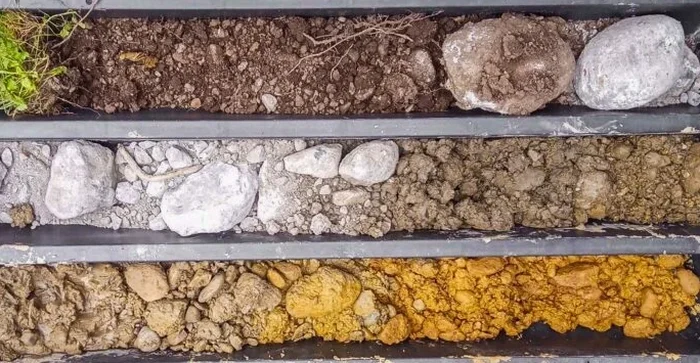
Our exploratory test pit service is not just a hole in the ground. We package it with the supporting field and lab work you need to turn an observation into a design parameter.
Test Pit Logging and Sampling
Full stratigraphic log with Munsell colour, moisture condition, and photo record. Disturbed and block samples collected from each layer, bagged and labelled for the lab.
In-Situ Density Verification
Sand cone density testing adjacent to the pit on compacted backfill or subgrade layers, with immediate field density and moisture content reported.
Groundwater Observation and Dewatering Advice
Measurement of seepage rate and stabilized water level. Practical recommendations for dewatering during construction based on observed permeability and soil type.
Frequently asked questions
How deep can you excavate a test pit in Richmond before hitting groundwater?
In most of Richmond the water table sits between 0.6 m and 1.5 m below grade, depending on the season and proximity to drainage ditches. We can excavate below the water table using a sump pump or well-point dewatering, but it adds time and cost. For depths beyond 4.5 m we typically recommend switching to a SPT drilling program because the pit becomes uneconomical and shoring gets complex.
What does an exploratory test pit cost in Richmond?
A standard test pit with logging, sampling, and a brief report typically runs between CA$730 and CA$1,130 per pit, assuming reasonable access and no major dewatering. The price moves toward the upper end when we need stepped benches, extended shoring, or multiple pits in the same day.
Can you backfill the pit and compact it so we can build over it the same week?
Yes, we backfill in 200 mm lifts with a plate compactor or jumping jack, depending on the material. If the area will carry structural loads or pavement, we verify compaction with a sand cone density test on each lift. We provide a compaction certificate for the city’s building permit file.
Do you need a locate request before digging a test pit?
Absolutely. We file a BC 1 Call ticket at least three business days before mobilization. Richmond has dense utility corridors along No. 3 Road and Westminster Highway, and many older subdivisions have undocumented service laterals. We hand-expose any marked utility within 1 m of the pit perimeter.
What information do I get from the pit log that I won’t get from a borehole?
You get a direct view of the pit wall: laminations, fissures, root holes, oxidation stains, and the true thickness of organic layers. You can see how the soil breaks when you cut it with the bucket, which tells you a lot about its strength in the undisturbed state. A borehole log gives you a vertical line; a pit gives you a cross-section you can photograph and measure.